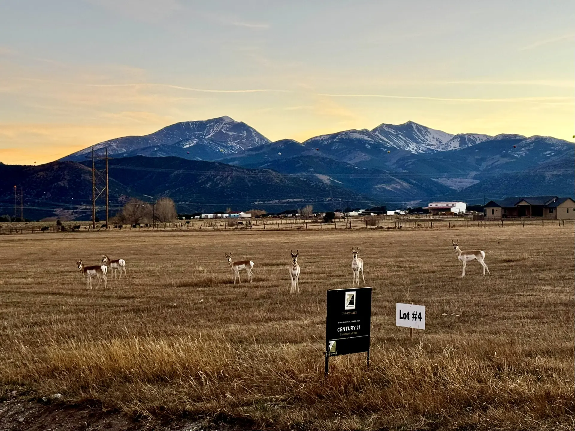


One of the best things about rural living is sharing the landscape with wildlife. Peering out the window and seeing a moose in the yard. Walking in the woods and catching a fleeting glimpse of a bobcat. Prowling ponds after dark to view the spring salamander migration. Sometimes their presence is taken for granted, but keeping wildlife as visitors, especially for a developing area, can require knowledge and intentionality.
Historically, conservation groups have focused on protecting pristine places that have intact ecosystems. But a rising awareness in the last 20 years has prioritized the importance of connecting those different habitats. Many animals need to move for their survival, and maintaining connections between habitat areas is crucial for preserving biodiversity and adapting to climate change. Rather than protecting natural islands in a sea of development, there is a need for islands of development in a sea of wild or semi-wild landscapes.
“There’s a lot of overlap between ranchers and farmers, people who really care about hunting, and those who care about recreation and a quiet rural-feeling community,” said Kylie Paul with the nonprofit Center for Large Landscape Conservation. “That overlaps with wildlife movement, and the value of keeping it intact is pretty robust across rural landscapes.”
Habitat connectivity is a win-win for people, too, said Paul. Most towns want to encourage development while retaining their rural character, sense of place, and natural rugged feel. Minimizing sprawl and incentivizing density in towns can preserve those features while encouraging walkability and affordability.
Local Planning
Local governments have land-use authority over nearly two-thirds of land in the United States. Elected local officials and citizens can preserve wildlife habitat connectivity by guiding growth within their jurisdictions, for example by protecting migration pathways and concentrating new homes near existing towns. In addition, conservation policies might be more successful now on a local level rather than the federal one. Many rural communities want increased development and planning to ensure it happens in the most desired places.
To that end, Paul recently co-authored a study commissioned by Pew Charitable Trusts and released by the Center for Large Landscape Conservation. “Integrating Wildlife Habitat Connectivity Into Local Government Planning: Examples, Recommendations, and Resources for U.S. Towns and Counties” incorporates case studies, policy tools, and suggestions of how to safeguard connected habitat.
“It can be overwhelming and confusing for local governments to figure out what actions they can take to address ecological and community concerns over sprawl,” said Paul. “We found examples across the country to help anyone lacking capacity to do their own research. The resources section has ideas to embed habitat connectivity into long-range plans, zoning, and development reviews to guide growth.”
The ability to enact habitat connectivity depends heavily on what is codified in local ordinances and plans. Paul said there are a variety of first steps for local governments, depending on what exists in the community. One fundamental decision is including wildlife and greenspace concerns in comprehensive or master plans, which usually require updating every five to 10 years.
“Often, a community’s desire to preserve its rural character emerges when development pressures occur,” Paul said. “Unfortunately, that can be too little, too late. We hope this report encourages proactive efforts to help communities balance growth with conservation. It shares lots of options beyond regulation, like incentives and engagement with groups.”
Mapping natural resources and communities is another important action to take, according to the report. Data about locations of endangered species and migration corridors often already exists on the state level, and local leaders can begin by compiling what is already known. Reaching out to state agencies and departments responsible for fish and wildlife can also be fruitful, as they may have staff that focus on land-use planning. Some states have funds or other resources to assist municipalities with more detailed planning. Armed with knowledge, communities can incorporate priorities into functional plans, zoning ordinances, subdivision regulations, site plan reviews, or incentive strategies.
Jericho, Vermont
Vermont imparts most land use planning to its 268 separate municipalities. It also offers one of the most comprehensive programs to support them in that work, according to Jens Hawkins-Hilke, a Conservation Planning Biologist with the Vermont Fish & Wildlife Department who offers technical assistance for habitat connectivity.
“While Vermont is the most rural state in the lower 48 by some measures [Editor’s Note: not all definitions of rurality rank Vermont as the most rural because different government agencies use different definitions of rural], sprawl development is a huge problem here,” Hawkins-Hilke said. “In many ways, it is our brand to live a rugged rural lifestyle at the end of a long driveway.”
The town of Jericho has only 2,000 people but it is located near Burlington, the state’s biggest city. It’s on the cusp of a development transition. In the 2010s, Hawkins-Hilke assisted Jericho in receiving a regional planning grant to conduct an extensive natural resources inventory. It identified special habitats such as rock cliffs that are important for bobcats and seasonal ponds crucial for amphibians.
Residents gained a better understanding of what they have and how the presence of wildlife is connected to the current habitat and development pattern. The data – and an extensive outreach and educational campaign by local proponents – convinced the town to change its planning framework.
In 2018, the municipality adopted a natural resource overlay that identifies sensitive areas. Threatened and endangered species, vernal pools, forested riparian areas, and rarer upland natural communities were ranked as primary “because they are rare, irreplaceable, unique, or otherwise essential.” Thanks to the regulatory tool of an overlay zone, Jericho is concentrating growth in village centers and protecting these primary wildlife areas.
“The single most important element that makes things happen in Vermont is local volunteers,” said Hawkins-Hilke. “In Jericho, they hosted office hours for people concerned about regulations and explained how it would affect specific landowners. It went a long way to allay fears.”
Chaffee County, Colorado
Chaffee County, Colorado, is on the cusp of development for a different reason. With a population of about 20,000, the county has a long legacy of agriculture but is in the midst of an outdoor recreation boom. Its natural amenities include a high concentration of 14,000-foot mountains, a heavily rafted stretch of the Arkansas River, excellent fishing, and world class mountain biking. When it came time to create a new comprehensive plan in 2020, retaining wildlife and rural character was top-of-mind.
“Our neighboring communities have gotten famously unaffordable, and folks are getting priced out and moving to Chaffee County,” said Miles Cottom, the county’s community planning and natural resources director. “We would have loved to get started five years sooner.”
Ten years before, the county had adopted uniform zoning of two acre lots, no matter the location. The results were land speculation, increasing rural traffic, and changes in wildlife movement. The new plan allows for the same amount of development but with different densities depending on the distance from towns. Some exemptions were added after meeting with members of the development and agricultural communities.
Planning leaders were encouraged by a 2018 community survey, where over 90% of respondents said they would change recreation behaviors to accommodate wildlife. There was a broad mix of people who cared: wildlife advocates, sport hunters and fishers, even ranchers and farmers who had challenges with grazing wildlife among their livestock.
The policies incentivize conservation subdivisions. Now, developments in “Conservation & Agriculture” districts can have one homestead per 35 acres. They are granted a quadruple density bonus if two-thirds of the land is preserved in perpetuity – a 300-acre development, for example, could have 32 lots on 100 acres if the remaining 200 contiguous acres are set aside for conservation.
The fact that 85% of Chaffee County is federal public land made some residents question the need for conserving the remaining acreage. Protections for both federal and local properties are necessary because migration corridors cross public and private lands alike. Plus, most people enjoy the rural lifestyle and small-town feel the plans protect.
“We had to find a balance between planning for wildlife habitat and allowing for the economic development that rural communities need to continue to survive,” Cottom said about the success of the Chaffee County plan. “I think we got there.”